Russia is a country of incredible scale and natural diversity. From the harsh Arctic expanses to the subtropical Black Sea coast, from the majestic Caucasus Mountains to the vast Siberian forests, it boasts everything nature has to offer.
The Most Beautiful Places in Russia
A guide to Russia’s natural attractions worth visiting
With so many incredible destinations, deciding where to go can be a challenge. That’s why we’ve put together this guide to the most beautiful natural places in Russia — from world-famous landmarks to remote corners rarely seen by travellers — highlighting what makes each one unique and why they’re worth visiting.
Quick Navigation
The Most Beautiful Places in Russia According to UNESCO
Mountains and Volcanoes
Mount Elbrus (Kabardino-Balkaria)
Altai (Altai Krai, Altai Republic)
Volcanoes and Hills of Kamchatka
Plateau and Cliffs
Lena Pillars (Yakutia)
Weathering Pillars
Putorana Plateau (Krasnoyarsk Krai)
Caves and Canyons
Kungur Cave (Perm Krai)
Ruskeala Marble Canyon (Karelia)
Lakes and Other Water Wonders
Lake Baikal (Irkutsk Oblast, Buryatia)
Valley of Geysers (Kamchatka)
Avacha Bay (Kamchatka)
Islands and Archipelagos
Shantar Islands (Khabarovsk Krai)
Commander Islands (Kamchatka)
Wrangel Island (Chukotka)
Deserts and Sand Dunes
Curonian Spit (Kaliningrad Oblast)
Sarykum Dune (Dagestan)
Chara Sands (Transbaikal Territory)
Nature Reserves and Parks
Dzheyrakh-Assa Museum-Reserve (Ingushetia)
Sikhote-Alin Nature Reserve (Primorsky Krai)
The Most Beautiful Places in Russia According to UNESCO
The UNESCO World Heritage List includes 11 natural and 18 cultural sites located in Russia:
the Altai Mountains;
the Lena Pillars in Yakutia;
the Putorana Plateau on the Taymyr Peninsula;
the Volcanoes of Kamchatka;
the Western Caucasus Mountains;
Wrangel Island in Chukotka;
the Curonian Spit — listed as a single unique natural site that unites nature parks in Lithuania and Russia;
the Sikhote-Alin Nature Reserve in Primorsky Krai;
and several other locations that are less accessible to travellers.
There is also a UNESCO World Heritage Tentative List. Among Russia’s natural landmarks included there are the Commander Islands in Kamchatka, the Valaam Archipelago, the Great Vasyugan Mire in Siberia, and the Krasnoyarsk Pillars. Moreover, there is even a separate list of sites being considered for inclusion in the Tentative List.
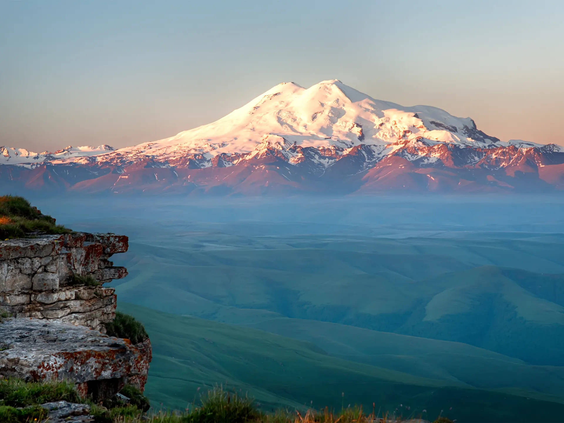
Both summits of Mount Elbrus are classified as “five-thousanders”
© iStock
Mountains and Volcanoes
Mount Elbrus (Kabardino-Balkaria)
Mount Elbrus is the highest mountain not only in Russia but in all of Europe. Both of its summits belong to the “five-thousander” category. The western peak rises to 5,642 meters above sea level, while the eastern peak reaches 5,621 meters. The two peaks are connected by a saddle.
Elbrus is one of the most popular mountains among both Russian and foreign climbers. It is included in the Seven Summits list, which features the highest mountain on each continent.
In addition to mountaineering, the Elbrus region is a well-known ski resort, with numerous tourist centers that operate year-round. Expeditions to the summit are also organized throughout the year, although the climb becomes significantly more difficult in winter.
Altai (Altai Krai, Altai Republic)
The Altai Mountains are located at the intersection of Russia, Mongolia, China, and Kazakhstan. Within Russia, the Altai region is divided between two federal subjects: Altai Krai, with its capital in Barnaul, and the Altai Republic, whose capital is Gorno-Altaysk.
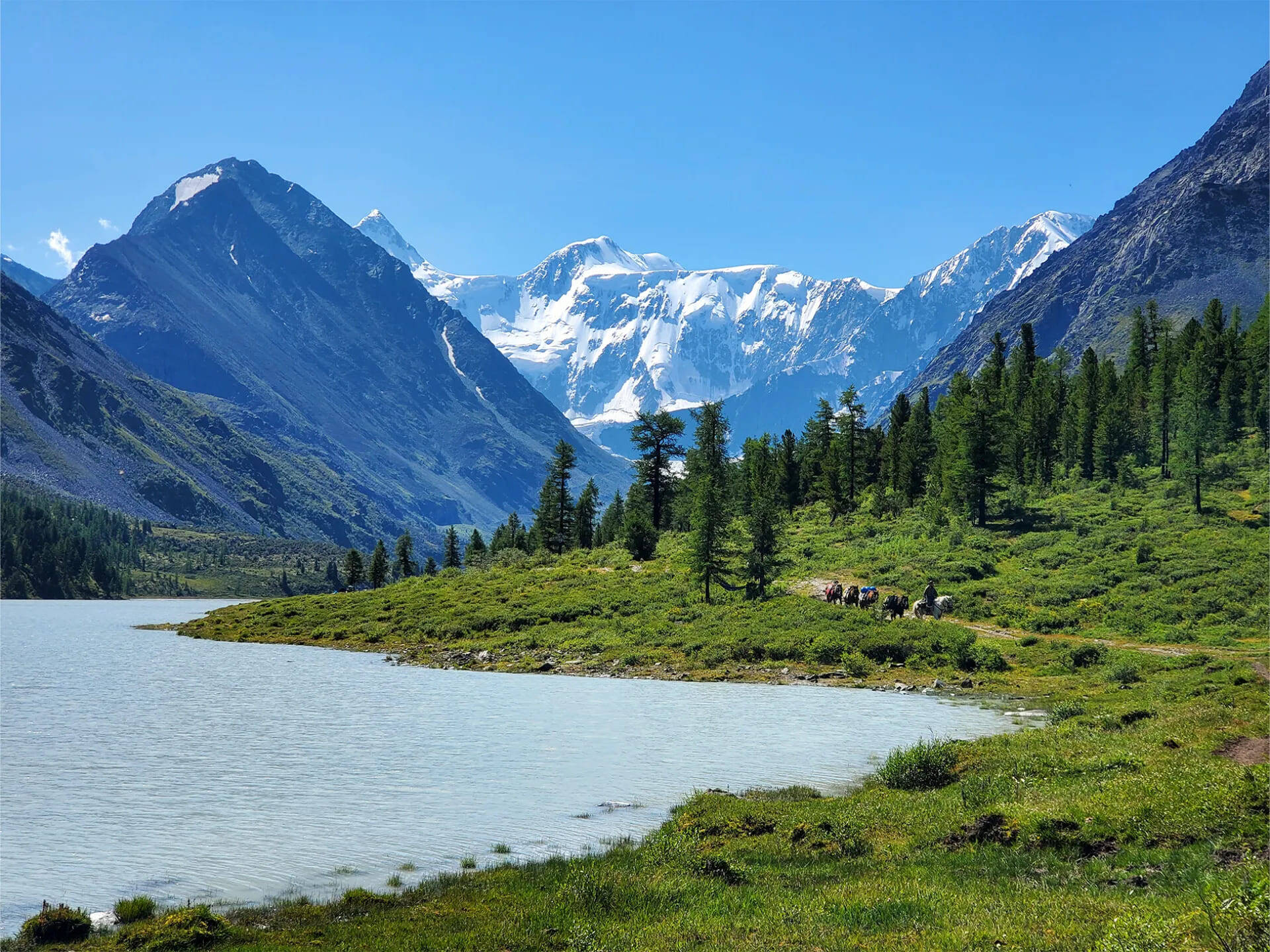
Mount Belukha ranks 20th among the highest peaks in Russia
From the RussiaDiscovery archive
This mountain system is inscribed on the UNESCO World Heritage List under the name “Golden Mountains of Altai.” The site includes Mount Belukha, Lake Teletskoye, the Ukok Plateau, and two nature reserves — Katunsky and Altaisky.
We also recommend seeing the following in Altai:
- Altai Mars near the Kyzyl-Chin River;
- a geyser lake with cold springs that never freeze, even in winter;
- one of the most scenic roads in the world — and one of Russia’s oldest routes — the Chuysky Trakt;
- caves with ancient rock carvings (petroglyphs) and much more.
In Altai, you’ll find snow-capped mountain peaks, turquoise lakes, picturesque waterfalls, and historical landmarks. You can see all the highlights that attract travellers from across Russia on our “Golden Ring of Altai” tour.
Volcanoes and Hills of Kamchatka
The volcanoes are collectively inscribed as a single UNESCO World Heritage Site — “Volcanoes of Kamchatka.” The territory protected by UNESCO in Kamchatka is divided into four areas: Nalychevo, Yuzhno-Kamchatsky, Klyuchevskoy, and Bystrinsky nature parks.
A total of 330 volcanoes are concentrated within these protected zones. The highest of them is Klyuchevskaya Sopka (4,835 meters). The most popular for climbing are Mutnovsky, Gorely, and Tolbachik. Every year, travellers from around the world visit Kamchatka to experience the beauty of Russian nature, climb its peaks, and gaze into its craters.
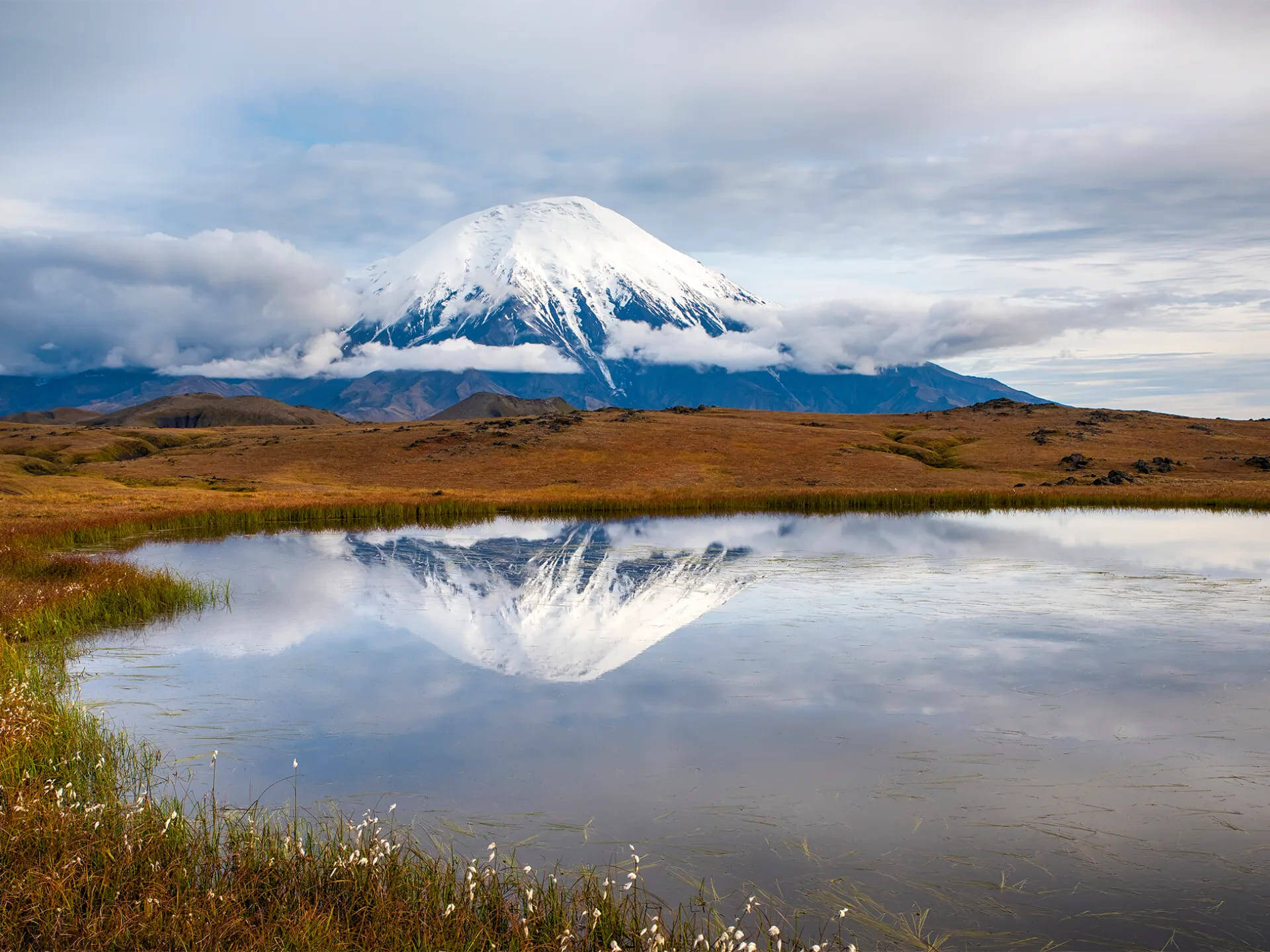
One of the most popular volcanoes in Kamchatka is Tolbachik
© iStock
We’ve gathered the peninsula’s most spectacular sights in our “Classic Kamchatka: From North to South” tour. This journey is part of our Gold Collection, featuring the most popular and time-tested expeditions.
Plateau and Cliffs
Lena Pillars (Yakutia)
The Lena Pillars Nature Park stretches for about 40 kilometres along the banks of the Lena and Sinyaya Rivers in Yakutia. The Lena Pillars are a multitude of towering, isolated rock formations that rise an average of 100 meters high. They are estimated to be around 400,000 years old — meaning they may once have been admired by mammoths, woolly rhinoceroses, and ancient bison, whose skeletons have been found in Yakutia.
From the republic’s capital, you can reach the Lena Pillars by boat or on a small cruise ship. Visitors can not only sail past this natural wonder, but also climb individual formations, swim in the cold waters of the Lena River — the fourth-longest river in the world — or walk along the tukulans, real sand dunes hidden amid the dense taiga. Bison are also bred here.
On the “Golden Cliffs of Yakutia” tour, you’ll raft down the Lena and Sinyaya Rivers, covering 20 to 43 kilometres per day on inflatable catamarans. You’ll set up camp, enjoy swimming and fishing, and explore the cliffs, grottoes, and caves. This family-friendly trip requires no special physical preparation.
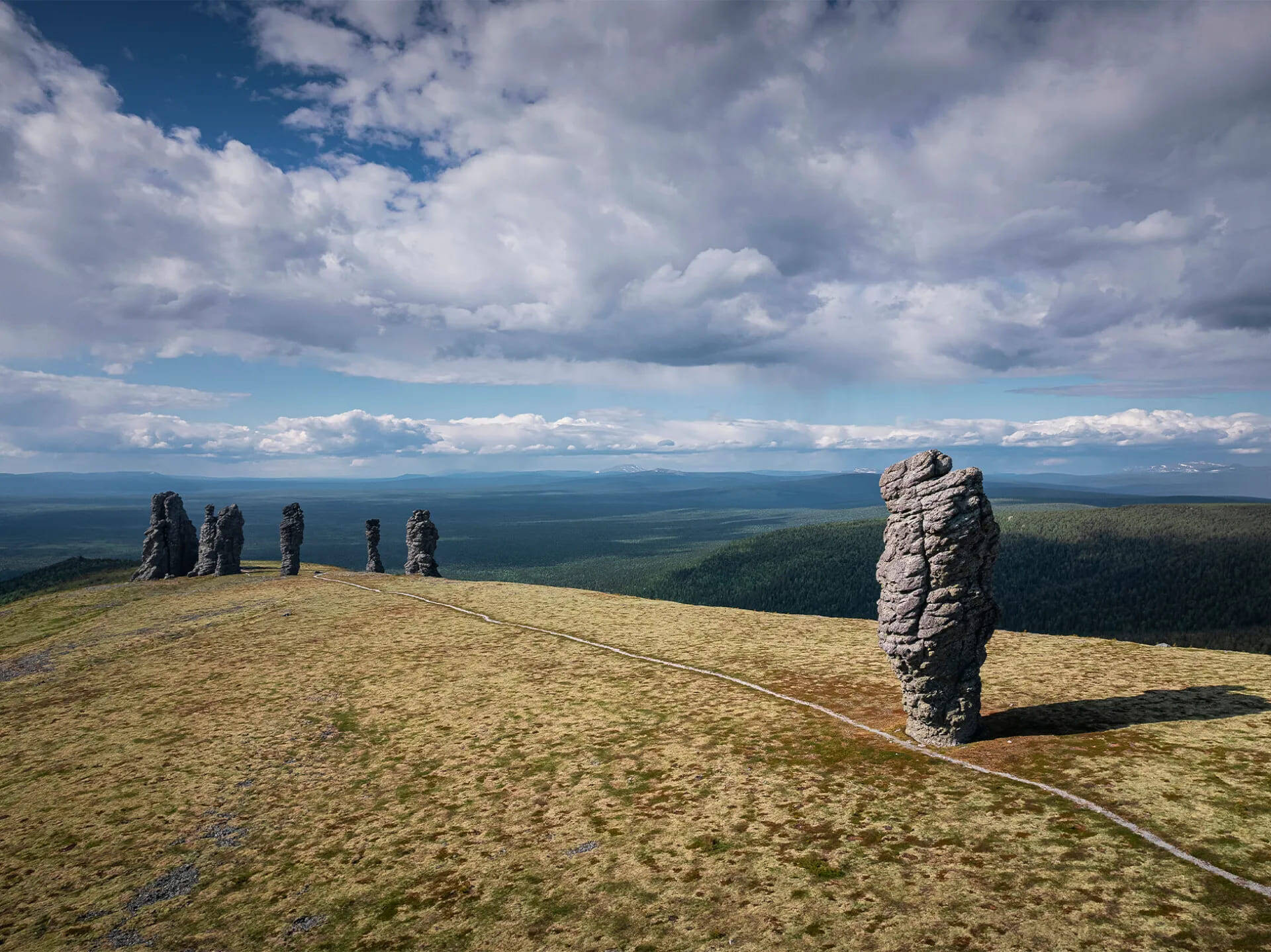
The famous weathering pillars are located on the Manpupuner Plateau
From the RussiaDiscovery archive
Weathering Pillars (Komi Republic)
The pillars stand on a plateau with the intriguing name Manpupuner (translated from the Mansi language as “Small Mountain of Idols”). Indeed, the stone pillars in Komi resemble ancient idols rising above the mountain and watching over the surrounding wilderness. Their unique shapes were formed by the weathering of rock — a process that has been ongoing for about 200 million years.
The plateau is part of the Pechora-Ilych Nature Reserve and lies almost on the border between the Komi Republic and the Khanty-Mansi Autonomous Okrug. Reaching one of the Seven Wonders of Russia is no easy feat — the plateau is remote and far from any populated area.
On the “Riddles of the Wild” tour, you’ll not only visit the legendary Manpupuner Plateau but also trek through mountains and protected forests, and take an airboat ride along the Pechora River.
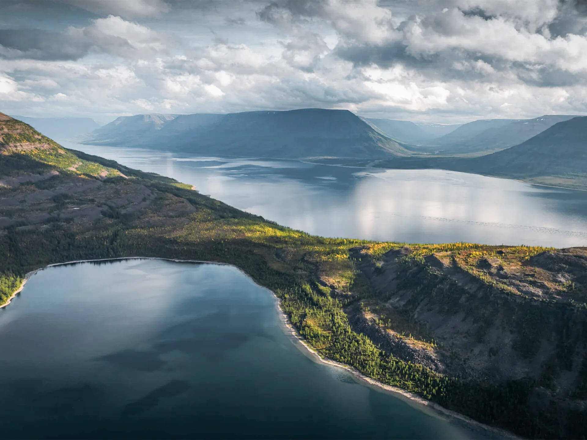
The Putorana Plateau — a place where you can see mountains without peaks
© Daniil Petin
Putorana Plateau (Krasnoyarsk Krai)
The Putorana Plateau is a mountain range covering 250,000 square kilometres on the Taymyr Peninsula. It is a stunning landscape of mountains that literally have no peaks. These flat-topped ridges are separated by numerous lakes and rivers. The plateau, along with the eponymous Putorana Nature Reserve, is home to the tallest waterfall in Russia and seemingly bottomless canyons. Interestingly, the plateau’s name means “lakes with steep banks” in the Evenki language.
Unfortunately, the plateau cannot be reached independently. Access is only possible via an organized transfer from Norilsk, such as on our “Mountains Without Peaks” tour.
This trip is perfect for those who enjoy combining an active outdoor program with a comfortable stay. You’ll experience boat trips, a mountain climb, and trekking to canyons and waterfalls, and relax at a secluded, well-equipped lodge overlooking Lake Lama.
Caves and Canyons
Kungur Cave (Perm Krai)
Kungur Cave is the most popular cave in Russia. It is neither the longest (ranked seventh in the world) nor the deepest, but it has plenty to offer. Inside the 5.7-kilometer-long cave are numerous underground lakes and dozens of grottoes. Stalactites and stalagmites of bizarre shapes hang from the ceilings, and vertical tunnels rise almost to the surface.
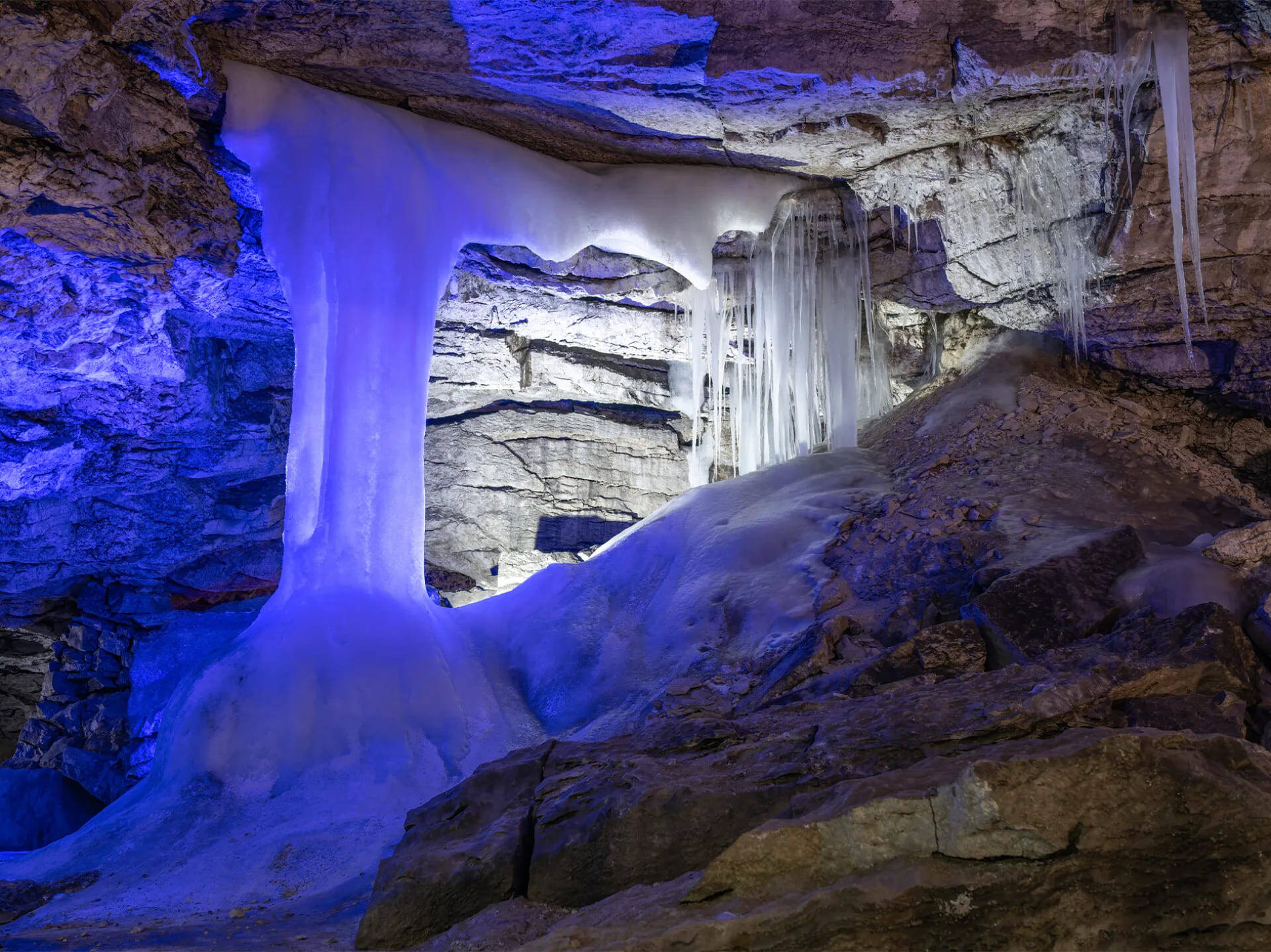
The Kungur Cave stretches 5.7 kilometers in length
© iStock
The cave is located in the city of Kungur, about 100 kilometres from Perm. It is easily accessible from the capital of Perm Krai, and the site is equipped with full tourist infrastructure. Visitors are allowed inside only on organized or private tours and can walk along a 1.5-kilometre section of the cave.
If you’re already thinking about how to spend the New Year holidays, consider the “Perm Mosaic” family tour. Winter fun, creative workshops, dense snow-covered forests, and deep caves await you.
Ruskeala Marble Canyon (Karelia)
One of the most famous attractions in the republic is Ruskeala Marble Canyon. During the 18th and 19th centuries, approximately 200,000 tons of marble were quarried here and used in the construction of palaces in St. Petersburg and its suburbs. In the 1940s, the abandoned quarry was flooded and later transformed into a nature park.
Ruskeala Mountain Park is located near the Karelian village of the same name, about 250 kilometres from Petrozavodsk. You can reach it from St. Petersburg by bus, organized tour, or even by train. Visitors can not only admire the canyon from the shore but also sail through it by boat — or even swim in its waters.
Lakes and Other Water Wonders
Lake Baikal (Irkutsk Oblast, Buryatia)
Lake Baikal is Russia’s largest and most famous lake. Here are some key facts about it:
- Its greatest depth reaches 1,641 meters — comparable to the depth of the sea;
- It contains the largest freshwater reserve in the world;
- Its waters are exceptionally clean and transparent;
- It is home to Baikal seals and Arctic cisco.
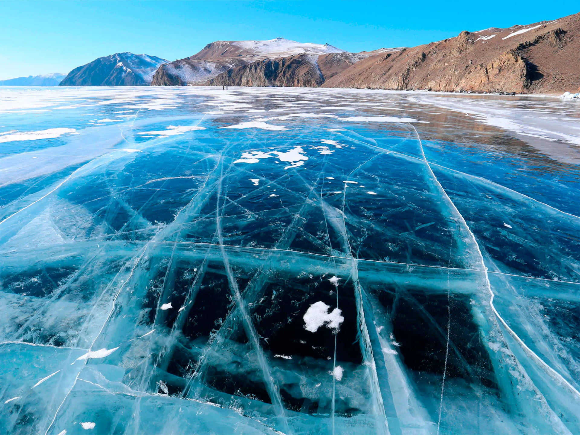
The ice of Lake Baikal is famous not only across Russia but around the world
From the RussiaDiscovery archive
Explore the transparent depths of Lake Baikal, visit Olkhon Island, the lake’s largest island, climb rocks sacred to shamans and take part in traditional rituals, and discover the culture and customs of the local people — all on our summer expedition, “Legends of Baikal”
Valley of Geysers (Kamchatka)
The Valley of Geysers is part of the UNESCO-protected area known as “Volcanoes of Kamchatka”, and within Russia, it officially belongs to the Kronotsky Biosphere Reserve. This unique geyser field covers just four square kilometres, yet it contains 90 geysers and hundreds of hot springs.
The Valley of Geysers is one of the most remote places in Russia. Join our “Classic Kamchatka” tour to explore the region safely with experienced guides.
Avacha Bay (Kamchatka)
Avacha Bay is a vast, sheltered, ice-free inlet of the Pacific Ocean located in southeastern Kamchatka. The bay covers an area of about 215 square kilometres and is said to be large enough to accommodate all the world’s merchant ships at once.
Almost the entire 24-kilometre stretch of the bay’s coastline is lined with steep cliffs that rise directly from the water. On one of them stands a lone white lighthouse, and majestic volcanoes can be seen in the distance.
Islands and Archipelagos
Shantar Islands (Khabarovsk Krai)
The Shantar Islands National Park is an untouched natural wonder located in Tugur Bay, just off the coast of Khabarovsk Krai. The main reason people travel to this remote and hard-to-reach area is to see whales. The Shantar Islands are considered the most whale-rich region in Russia. These sea giants come so close to the shore that they can be seen with the naked eye.
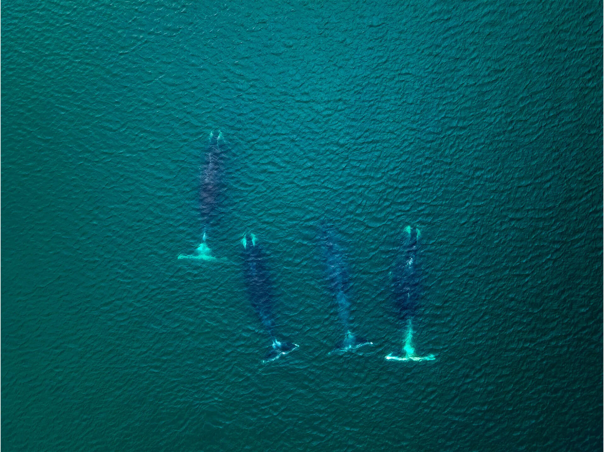
Meeting whales is one of the main reasons to travel to the Shantar Islands
From the RussiaDiscovery archive
Other highlights of the area include:
- whales and orcas in Ongachan Bay on the mainland;
- seal rookeries on Maly Shantar Island;
- thousands of seabirds nesting on Utichiy Island;
- salmon spawning in the island rivers;
- a weather station on Bolshoy Shantar Island — the only inhabited place in the archipelago.
Seeing whales is a dream for many travellers — even seasoned ones. You can try your luck and meet these sea giants on our "Archipelago of Discoveries" tour.
Commander Islands (Kamchatka)
Unlike the Shantar Islands, the Commander Islands are inhabited. Most of the local residents are Aleuts, and the only settlement — Nikolskoye — has a population of just 700. There are no typical tourist attractions here, only pristine nature. One exception is the grave of Vitus Bering, the explorer who discovered the islands, which is now a historical monument.
Travellers come to the Commander Islands to visit Russia’s largest marine reserve and to witness the incredible abundance of marine life found here. Whales, orcas, seals, and fur seals inhabit the coastal waters, and large bird colonies nest on the islands throughout the reserve.
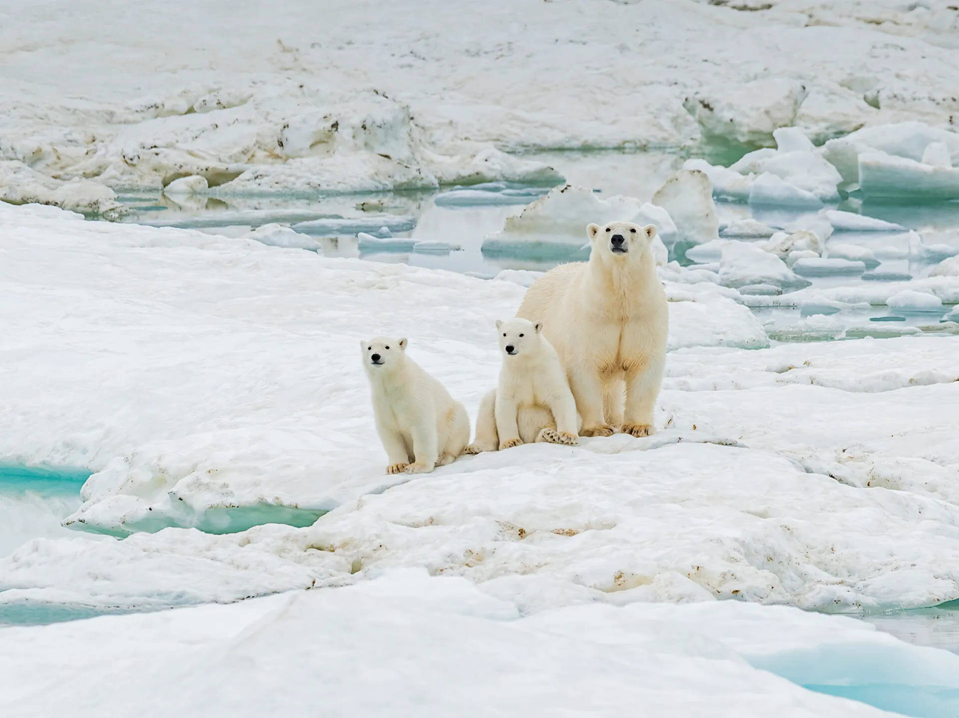
Wrangel Island is often called the “maternity ward” for polar bears
© iStock
Wrangel Island (Chukotka)
Wrangel Island lies in the Arctic Ocean, not far from the coast of Chukotka. The border between the Western and Eastern Hemispheres runs almost exactly through the center of the island. Only a few people live here — employees of the nature reserve and the weather station — along with a small base of the Russian Pacific Fleet.
The entire island is protected as a nature reserve and is listed as a UNESCO World Heritage Site.Special efforts are made to preserve the island’s vast walrus rookeries and to maintain the population of musk oxen, which were introduced from the mainland during the Soviet era.
Wrangel Island is often called the “maternity ward” of polar bears. It is one of the few places on Earth where these animals gather in large numbers to dig dens, give birth, and raise their cubs. Its isolation from major human settlements makes it relatively safe for the newborns. The surrounding waters are also rich in marine life and offer abundant food for the bears.
Deserts and Sand Dunes
Curonian Spit (Kaliningrad Oblast)
The Curonian Spit is a long, narrow strip of sand — 98 kilometres along the coast of the Baltic Sea. It stretches from Zelenogradsk to Klaipėda in Lithuania. The spit is part of two national parks of the same name — one in Russia and one in Lithuania.
This narrow landform, just 400 meters wide in places, is home to some of the highest sand dunes in the world, reaching up to 68 meters. It also lies on one of the major bird migration routes — up to 20 million birds fly over the Curonian Spit each year.
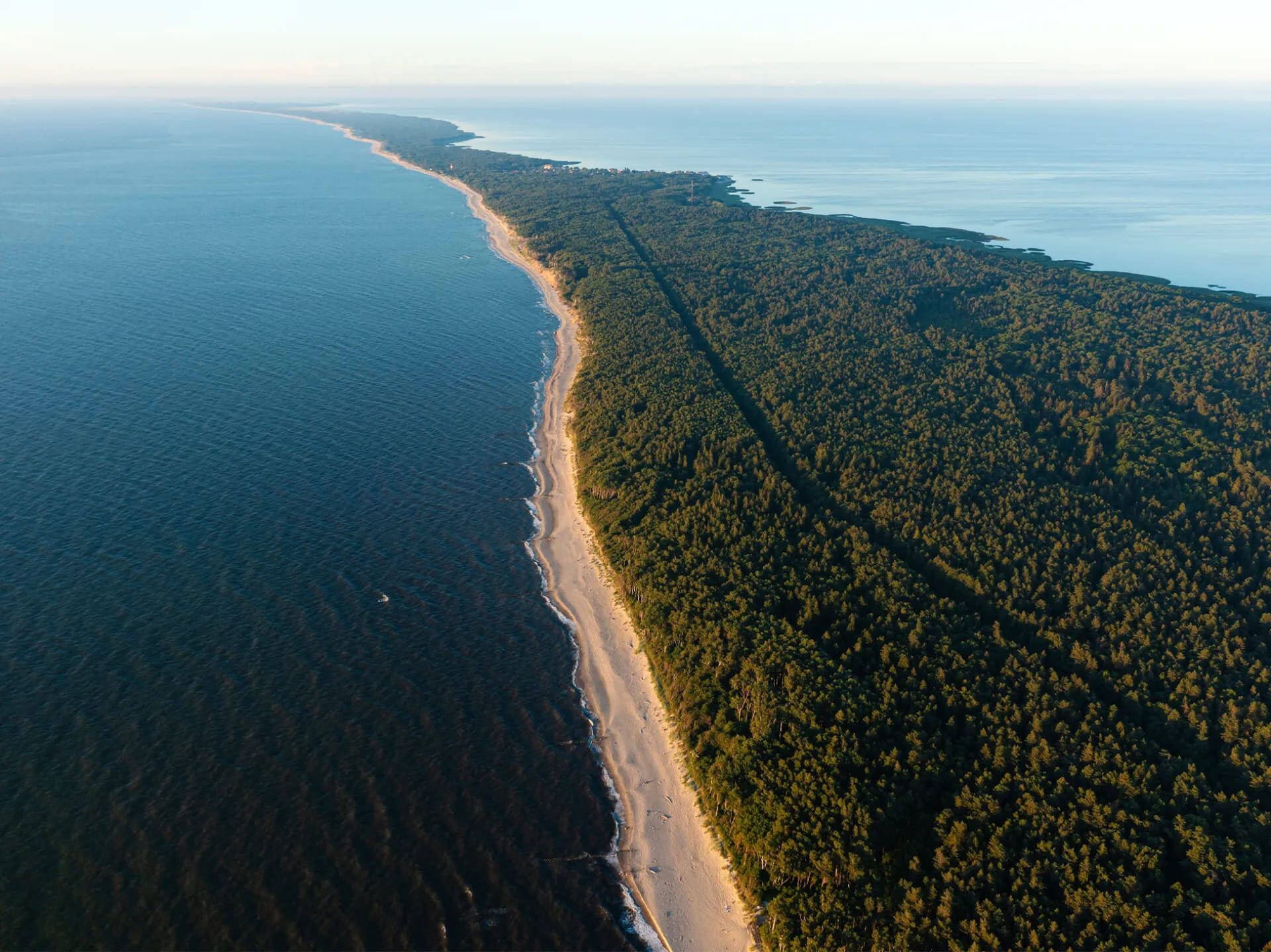
The Curonian Spit stretches from Zelenogradsk to Klaipėda in Lithuania
© iStock
Sarykum Dune (Dagestan)
The Sarykum Dune in Dagestan is considered one of the largest sand dunes in the world — a 250-meter-high mountain of sand. It was here that the famous Soviet film “The White Sun of the Desert” was shot.
Scientists believe that the sand was carried here by the wind and stabilized by small plants whose roots hold the slopes together. The dune is home to vipers, tarantulas, and scorpions, so be careful when exploring the area.
You can visit Sarykum Dune on the “5 Days in Dagestan” tour, which includes daily transfers and mountain hikes — with evenings spent relaxing in comfortable hotels.
Chara Sands (Transbaikal Territory)
The Chara Sands are a true desert in the Transbaikal Territory, similar to those of Central Asia. Covering about 50 square kilometres, the dunes stretch across dense taiga and impassable swamps, set against the backdrop of the snow-capped peaks of the Kodar Range. The desert lies in the Chara Valley, near the village of Chara, and forms a long, narrow strip of sand about five by ten kilometres in size.
The Chara Sands move with the wind and gradually migrate to the northeast, burying the taiga vegetation. Some dunes rise as high as 30 meters. Remarkably, even within this relatively small desert, real sandstorms are not uncommon. Unlike in other deserts, however, there are no scorpions or tarantulas here.
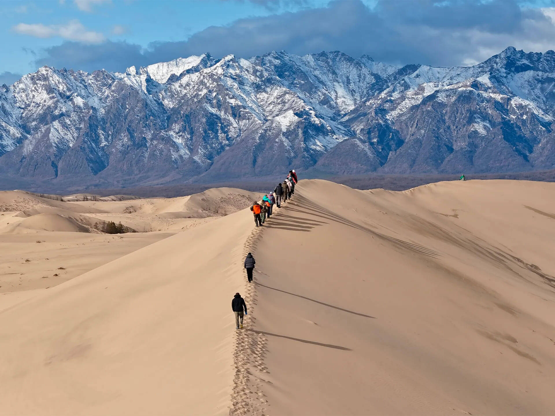
The Chara Sands spread out against the backdrop of the Kodar Mountain Range
From the RussiaDiscovery archive
Nature Reserves and Parks
Dzheyrakh-Assa Museum-Reserve (Ingushetia)
The Dzheyrakh-Assa Museum-Reserve is the pride of Ingushetia and one of its main attractions. The reserve includes not only mountain landscapes, but also some of the most ancient fortresses and tower complexes in the Caucasus:
- The striking medieval towers of Vovnushki, built as an extension of the surrounding cliffs.
- The ancient city of Egikal, once abandoned by its inhabitants. Several dozen stone buildings remain here, and archaeologists have found evidence of human habitation in the area dating back to the third millennium BC.
- The village of Erzi, known for its tall battle towers, some rising up to 30 meters. The settlement is believed to have originated as early as the 8th century.
The Sikhote-Alin Nature Reserve is listed as a UNESCO World Heritage Site
© Five Stars Tour Operator
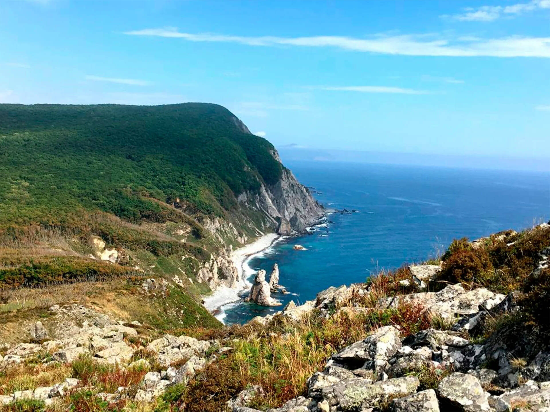
Sikhote-Alin Nature Reserve (Primorsky Krai)
The Sikhote-Alin Nature Reserve is located in the Russian Far East, in Primorsky Krai. It is best known as a refuge for endangered Amur (Ussuri) tigers, as well as Himalayan bears and spotted sika deer, all of which are specially protected in Russia.
The reserve’s extraordinary biodiversity was the main reason for its inclusion on the UNESCO World Heritage List. Its protected territory encompasses not only rich wildlife but also rare and endangered plants, forests, and lakes, including:
- Cedar forests and yew groves;
- The Abrek tract, home to the endangered long-tailed goral (a goat-like mountain ungulate);
- The Blagodatnoye and Golubichnoye lagoons, and rivers inhabited by Sakhalin sturgeon;
- Dozens of rare plant species, including the beautiful lady’s slipper orchids of the Far East.
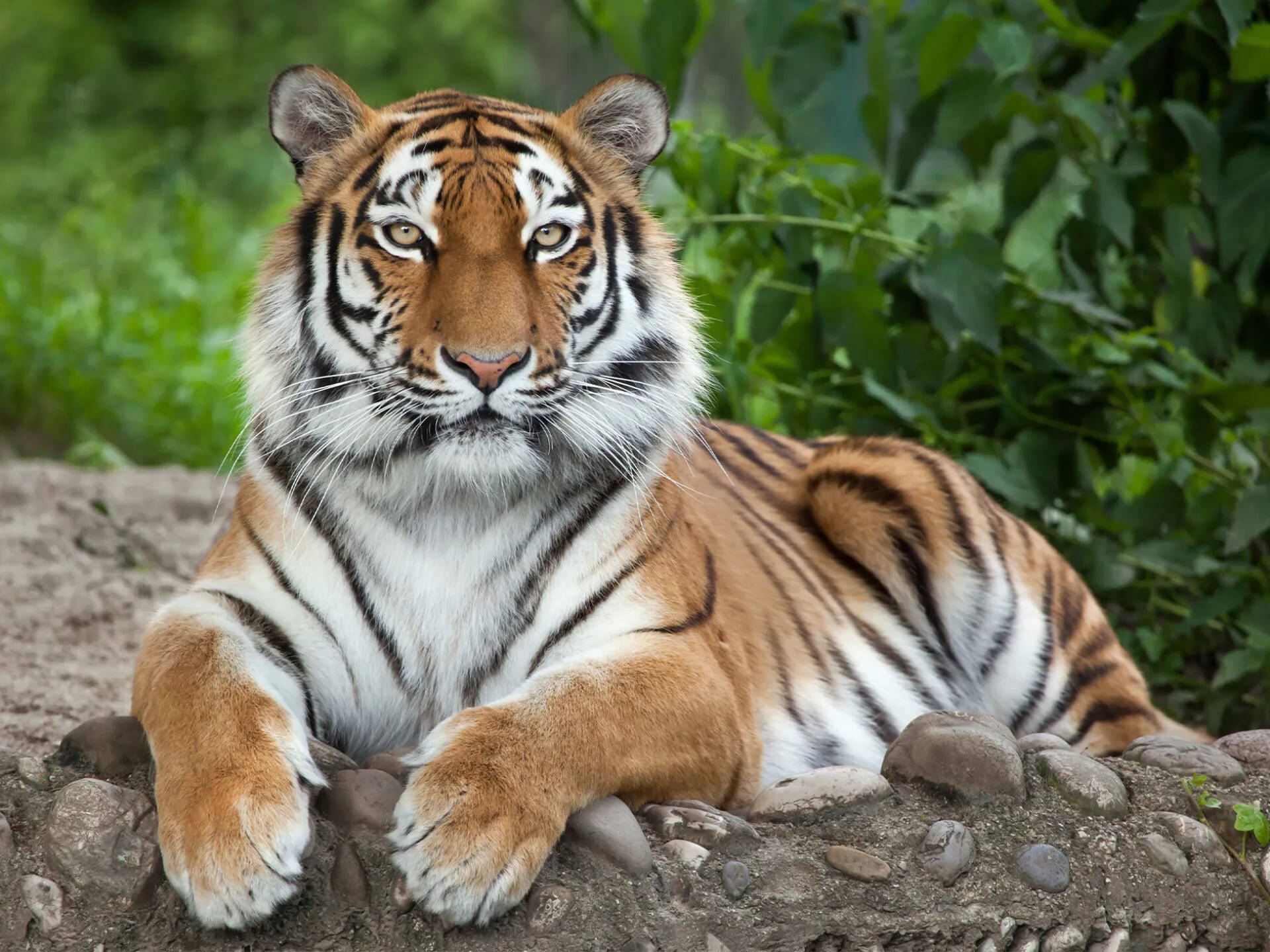
Amur tigers inhabit the territory of the Sikhote-Alin Nature Reserve
© iStock
The Sikhote-Alin Nature Reserve is open to visitors. You can explore its ecological trails and learn more about the Amur tiger, of which only about two dozen remain in the wild, as part of our grand Far Eastern expedition — “Primorye Circumnavigation.”
The expedition also includes visits to the Kema-Amginsky National Park and the Far Eastern Marine Reserve.
Explore our collection of journeys across Russia and around the world. If you need help choosing a trip, give us a call +7 (495) 104-64-36 or send us an email hello@russiadiscovery.ru.
Notice an error or inaccuracy?
Write to usSee also
All articles