Chuysky Trakt or Chuya Highway — one of the most scenic roads in the world according to National Geographic Traveler. It runs across the entire Altai Mountains and is famous for its ancient heritage sites and diverse landscapes.
The Chuysky Trakt: Secrets of Altai’s Main Road
Discover the ancient route that links Russia and Mongolia

In this guide, we explore the centuries-old history of Chuysky Trakt, the towns and villages worth stopping in along the way, and the region’s top natural attractions that draw travelers from all over the world.
Quick Navigation
Chuysky Trakt Today
The R256 highway stretches for 968 kilometers, starting in Novosibirsk, running through Altai Krai and the Altai Republic, and ending at the Mongolian border in the village of Tashanta. It’s the region’s major transportation artery.
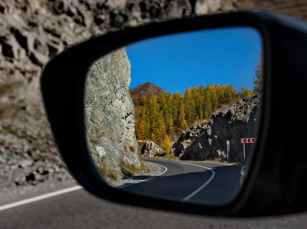
Most of the road is paved and regularly maintained. However, keep in mind that in certain sections — especially in the mountains — you’ll encounter steep climbs and descents, as well as serpentine roads.
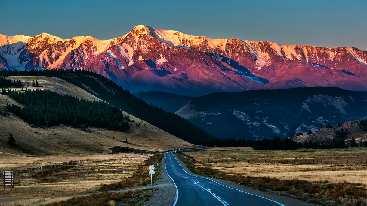
The landscape along Chuysky Trakt is incredibly varied: from plains and foothills to mountain ranges and narrow valleys. The scenery changes constantly along the route — first vast steppes, then dense forests and alpine meadows. In the distance, snow-capped peaks come into view.
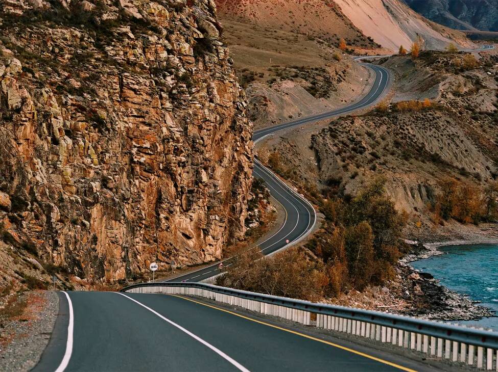
Some stretches of Chuysky Trakt wind along serpentine mountain roads
© Maksim Nazemtsev
History of the Trakt
Chuysky Trakt, as we know it today, is over 200 years old. But the lands it crosses were part of trade routes long before that. Centuries before roads and automobiles, caravan trails passed through here, linking Siberia with Central Asia.
Origins of the Route
The first mentions of mountain passes in this area date back to the era of the Great Migration, from 375 to 700 AD. Nomadic tribes traveled these mountain paths, driving their herds and trading with neighboring peoples.
The Middle Ages
In medieval times, these trails evolved into trade routes between Rus' and China. Russian merchants transported tools, honey, and other goods in exchange for silk, tea, and spices. A northern branch of the Great Silk Road passed through here; in Chinese chronicles it was known as the Mungal Tract.
Caravan trails once traveled this way
© iStock
Trade with China
From the mid-17th century, after southern Altai became part of Russia, the route began to see more use. Trade along the Chuya River was encouraged in part by religious pilgrimage: merchants would join groups of believers traveling to the upper reaches of the Katun River, meeting their demand for goods along the way.
By the 1850s, trade had become even more active. Russian merchants exchanged fabrics, axes, saws, hammers, haberdashery, and leather for Altai livestock and furs, as well as tea and spices from Mongolia, China, and Tibet.
At that time, the tract was still a mountain trail — narrow and rocky in places, making travel difficult. For nearly 250 kilometers, there was no proper road at all, which greatly complicated movement.
The First Improvements
Merchants took it upon themselves to improve certain sections of the route: building bridges and establishing ferry crossings. But large-scale reconstruction was far beyond their means.
From the 1860s to the 1890s, the state drafted plans to build a proper road. The authorities were reluctant to commit to major funding, but at the end of the 19th century they allocated a modest sum. Merchants raised a similar amount themselves, and the project finally began to move forward.
Today, Chuysky Trakt is a modern highway
© iStock
The 20th Century
At the beginning of the last century, the tract was transformed into a road suitable for horse-drawn carts, and merchants began using it more frequently.
Engineers later arrived in Altai. They carefully surveyed the area, mapped Chuysky Trakt, and proposed a new, improved, and expanded route. It was approved, and in 1925 automobiles traveled the road for the first time.
In the 1930s, the tract was compacted and covered with gravel, and bridges were built to replace dangerous crossings. The route of Chuysky Trakt shifted slightly: between the city of Biysk and the village of Cherga, the road was moved from the left bank of the Katun River to the right. By 1935, Chuysky Trakt had taken on nearly the same form we know today.
During and After the War
In Soviet times, Chuysky Trakt held strategic importance — military supplies arrived from Mongolia along this route. During this period, the road was reconstructed and widened. And in 1961, the name Chuysky Trakt was officially assigned to the highway stretching from Novosibirsk to Tashanta.
The last major reconstruction took place in the 1980s, when a new section was built over the Chike-Taman Pass. Today, Chuysky Trakt is a modern highway, with thousands of vehicles traveling it every day.
Chuysky Trakt on the Map
Key settlements along the Chuysky Trakt
Many settlements lie along Chuysky Trakt — from small villages to major cities. Below are the key points along the route:
Novosibirsk — the starting point of the journey. You can fly here from Moscow to Tolmachevo Airport in about four hours; ticket prices start at around 6,700 rubles without checked luggage.
Biysk — a historic merchant town located at the confluence of the Biya and Katun rivers. Travelers come here for historical tourism: to see merchant-era architecture and visit museums. Rafting trips and hiking in the surrounding area are also popular.
Mayma — the first settlement in the Altai Republic, located next to Gorno-Altaysk. It’s a great place to get acquainted with Altai culture and rural life. The town is also a convenient base for day trips around the region.
Gorno-Altaysk — the capital of the Altai Republic and the region’s administrative and cultural hub. Visitors stop here to explore the local history museum and buy souvenirs. Many excursions into the Altai Mountains start from here.
Chemal — a popular tourist destination known for its picturesque surroundings. Outdoor activities are the main draw: rafting, horseback riding, fishing, swimming in the Katun, and hiking to local attractions such as the Chemal Hydroelectric Power Station and the rocky island of Patmos.
Ust-Sema — an important transportation junction where Chuysky Trakt branches into several directions.
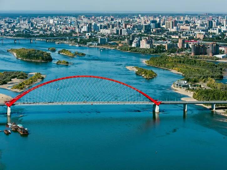
Chuysky Trakt begins in Novosibirsk
© iStock
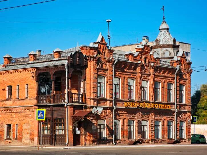
People visit Biysk to explore merchant architecture and local museums
© photogenica
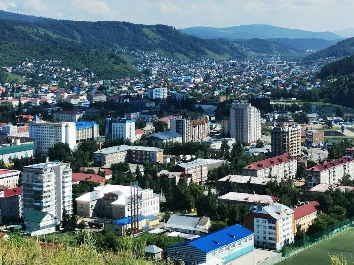
Gorno-Altaysk is the administrative and cultural center of the Altai Republic
© Natalya Konovalova
Chemal is famous for its scenic surroundings
© photogenica

Shebalino — a large village in the scenic valley of the Sema River. Popular activities here include hiking and horseback riding, fishing, and foraging for mushrooms and berries.
Onguday — a village in the very heart of Altai. Nearby you’ll find the picturesque Chike-Taman Pass.
Aktash — a major village on the banks of the Chuya River. This is where the road to “Mars” begins — the colorful, otherworldly hills that resemble the surface of the Red Planet. The area is popular for extreme tourism, mountain trekking, and rafting on the Chuya.
Kuray — a village in the Kuray Steppe, surrounded by mountains. It’s often chosen for peaceful, contemplative getaways and photo trips. Mountaineering and glacier excursions are also common here.
Kosh-Agach — a large village in the south of the Altai Republic. Travelers come to learn about the culture and everyday life of the southern Altai peoples. It’s the starting point for trips to high-mountain lakes.
Tashanta — a border settlement and the final stop on Chuysky Trakt.
Traveler Tips
Book your accommodation in advance, especially if you’re planning a trip to Altai in summer — the high tourist season. If you’re traveling by car, refuel ahead of time: distances between gas stations on the highway can reach 100–120 kilometers.
We recommend carrying cash, as card payments aren’t accepted everywhere. Be prepared for spotty mobile service as well — download offline maps of your route in advance.
Be sure to try traditional dishes at local cafés, such as kocho meat soup, kurut cheese, and chok-chok sweets.
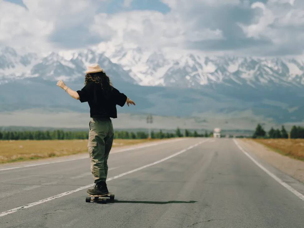
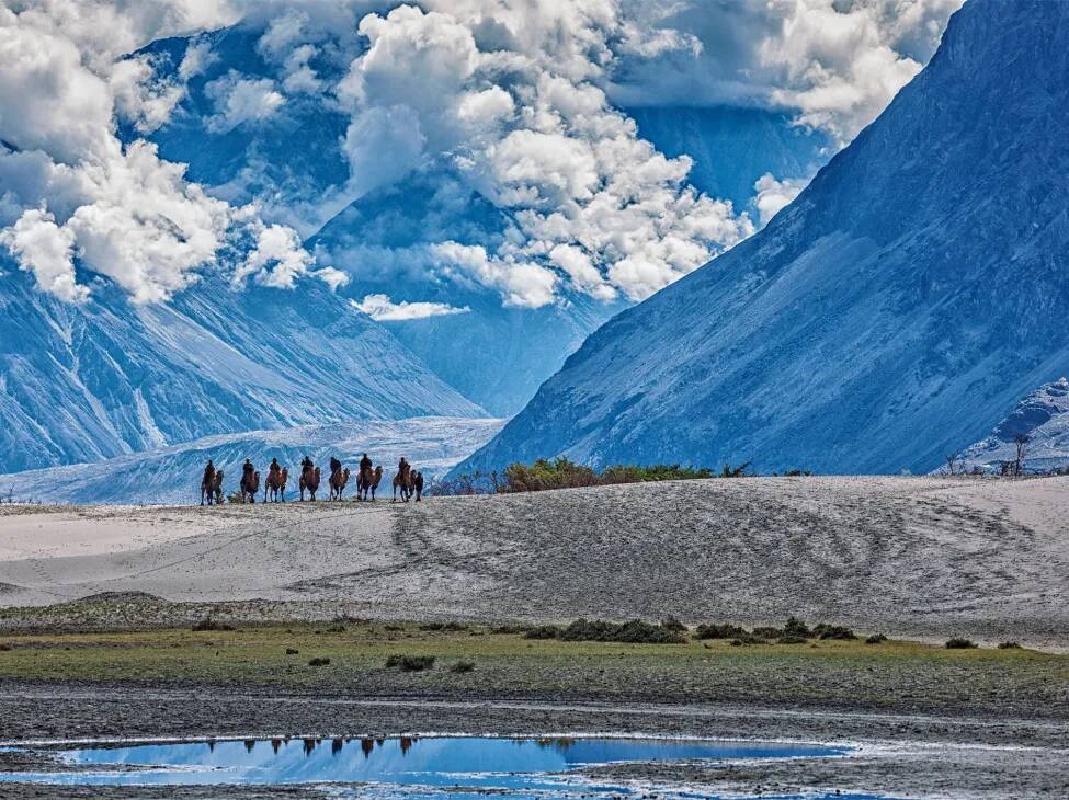
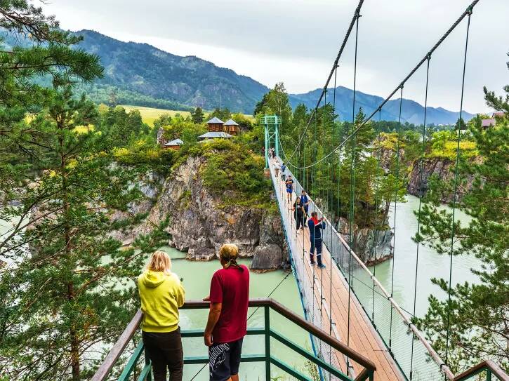
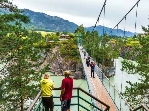
The Chuysky Trakt isn’t only for cars
© RussiaDiscovery
Join us on our tour along Chuysky Trakt and discover the hidden corners of the Chuya and Kurai Steppes.
What to Bring
Even in summer, pack warm clothing — mountain weather changes quickly. And if you’re traveling along Chuysky Trakt in winter, don’t forget:
a windproof ski suit
thermal underwear
a warm fleece or insulated layer
warm socks
a hat
gloves or mittens
insulated boots
What to See Near Chuysky Trakt
Chuysky Trakt is a true treasure trove of natural and cultural landmarks. Below are places you can visit on your own or as part of our active tour:
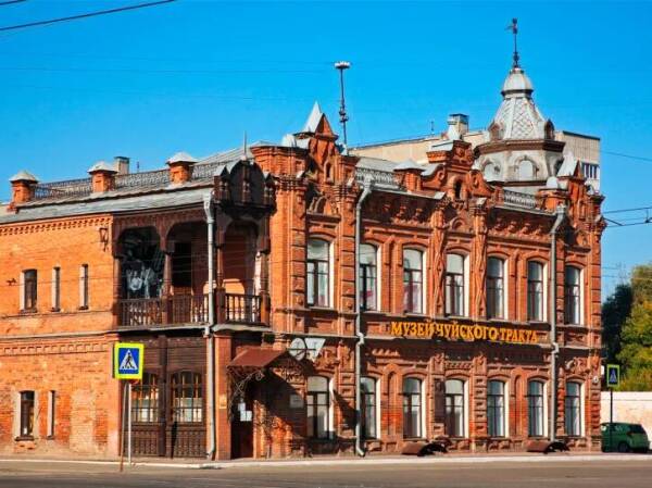
- Chuysky Trakt Museum in Biysk. Learn about the history of the road’s construction and discover the traditional way of life of Altai’s Indigenous peoples.
- Lake Manzherok on the right bank of the Katun. In summer, people swim, rent boats and catamarans; in winter, they ski and snowboard at the nearby Manzherok ski resort.
- Tavda Caves on the left bank of the Katun, near the village of Tavda — a karst cave complex carved into limestone cliffs. It contains numerous grottos and tunnels where archaeologists have found traces of ancient human settlements.
- Chike-Taman Pass — one of the most scenic points along Chuysky Trakt. From the summit, you’ll enjoy panoramic views of mountain ranges and the valley below. There’s a viewpoint along with cafés and souvenir stalls. The pass is open year-round.
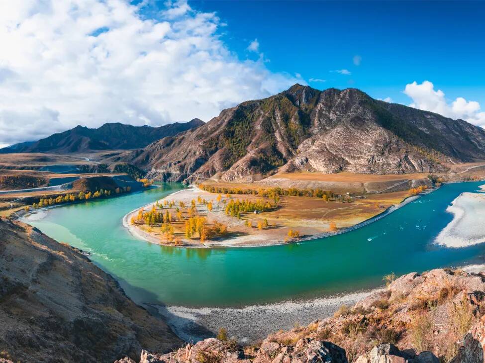
The Chuya and Katun rivers are different colors, giving their confluence an otherworldly look
© iStock
5. The confluence of the Chuya and Katun rivers (kilometer 712) — a unique natural phenomenon where the differently colored waters meet but don’t immediately mix, creating a striking contrast. There’s a viewing platform here. Locals consider this a sacred site, and nearby you’ll find ancient petroglyphs approximately 3,000 years old.
6. Kalbak-Tash, a petroglyph site near the village of Iodro. You can see ancient rock carvings dating back to the Neolithic period (6th–3rd millennium BC), including well-preserved depictions of people, carts, bulls, and domestic animals.
7. The Kurai Steppe — a vast open plain surrounded by mountain ranges. Spring is especially beautiful, when rhododendron (maralnik) blooms and turns the hills into a pink-violet carpet.
8. Geyser Lake — a small pond near Aktash where underground geysers bubble up, stirring blue clay from the bottom and creating mesmerizing patterns on the surface.
Explore our collection of Altai tours if you’d like to see the region’s highlights with your own eyes. We’ll be happy to help you choose and answer any questions—just give us a call at +7 (495) 104-64-36 or email us at hello@russiadiscovery.ru.
Contributors
Victoria Romanova
Author
Elizaveta Strogalshchikova
Editor
Yulia Kopyltsova
Executive Editor
Ezhena Bykova
Proofreader
Notice an error or inaccuracy?
Write to usSee also
All articles